Methane & emissions monitoring
Satellite-based detection and quantification for oil & gas, landfills, and industrial sites using Sentinel-2, Sentinel-5P, open-source workflows, and machine learning.
Nicholas Kinsella · Geospatial & Earth Observation
Independent consultancy supporting developers, operators, regulators, and research teams — from satellite-based emissions monitoring to spatial analysis you can act on.
Presented at
Services
Satellite-based detection and quantification for oil & gas, landfills, and industrial sites using Sentinel-2, Sentinel-5P, open-source workflows, and machine learning.
Spatial mapping, overlay analysis, environmental impact assessment, and constraint studies to support planning, permitting, and design decisions.
Workflow design, data processing, and technical support for organisations including the European Commission, landfill operators, and research groups.
PostgreSQL/PostGIS databases, GeoServer, OpenLayers, Python pipelines, and deliverables that integrate with your existing project environment.
Research
Open-source monitoring, published research, and operational landfill analysis — the core of my MSc and consultancy work.
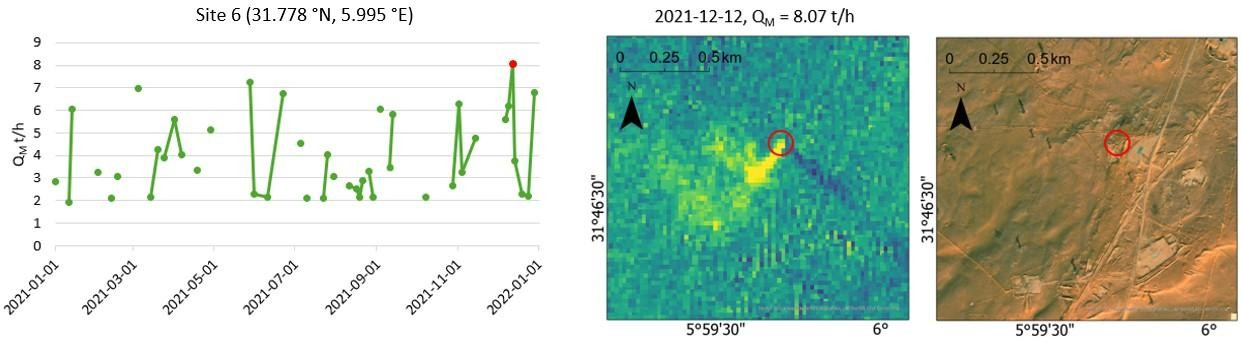
MSc research monitoring Algeria’s largest oil field (2021–2024). Awarded by OSNI and the Royal Geographical Society for outstanding postgraduate research.
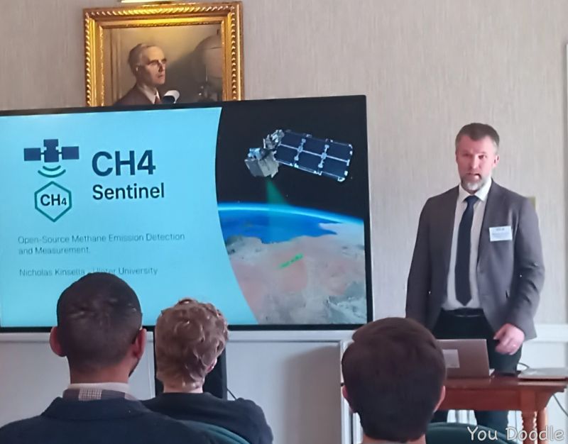
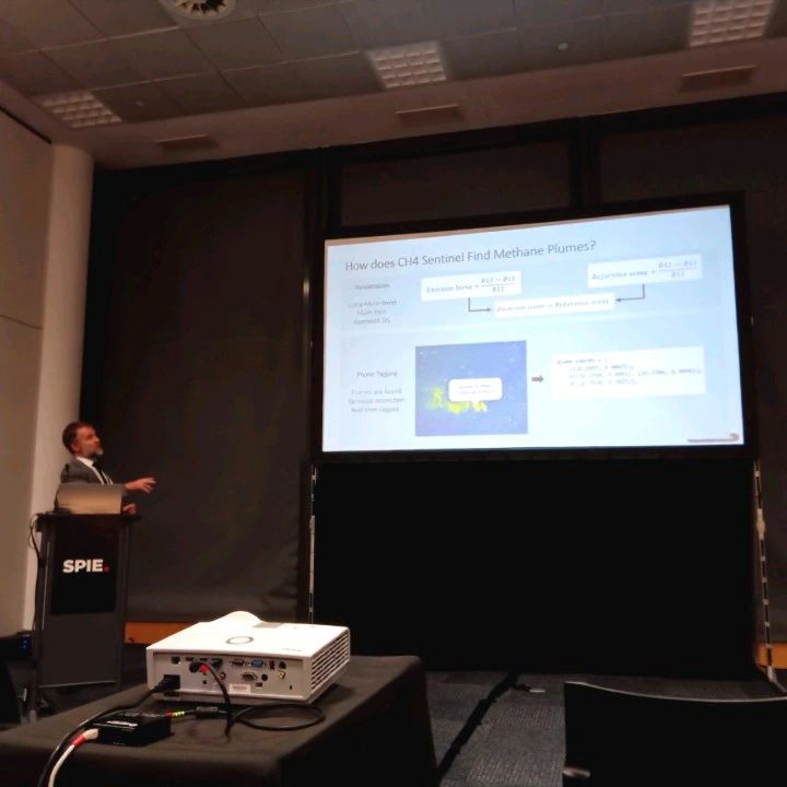
SPIE paper →Open-source tool to detect and quantify methane super-emitting point sources from Sentinel-2 SWIR data using a processor-light XGBoost workflow.
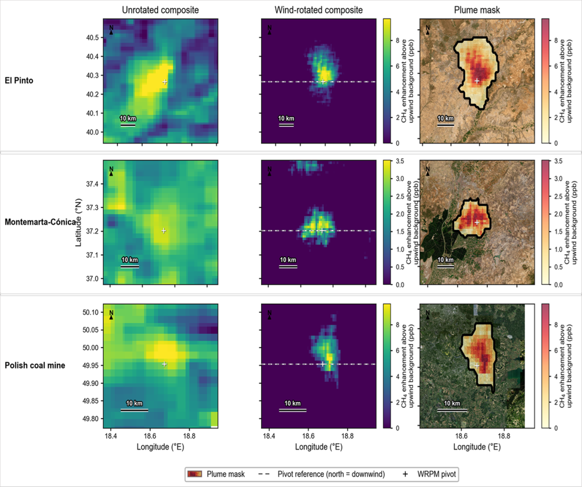
View on GitHub →Wind-rotated plume method using hundreds of daily Sentinel-5P passes to quantify landfill methane near Madrid and Seville.
Read the article →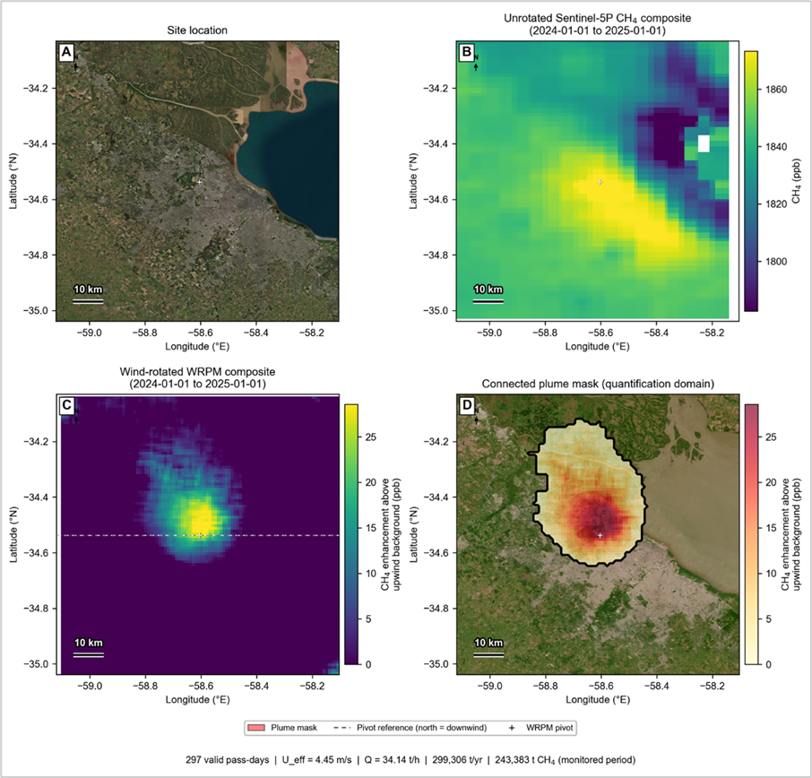
Web GIS and emergency planning for flood risk communication and response.
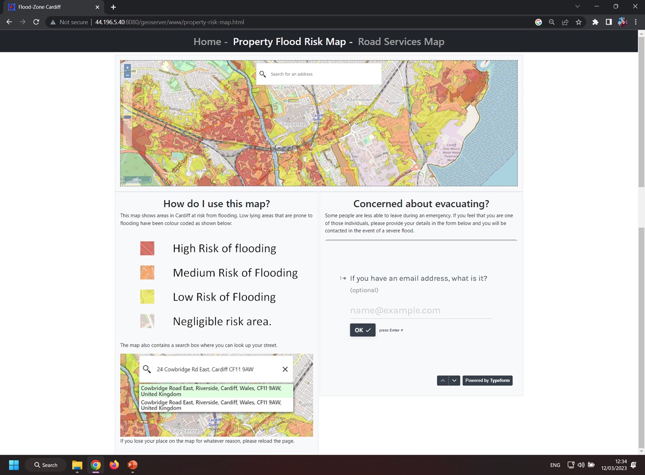
Interactive flood-risk map for Cardiff built with GeoServer, OpenLayers, and Bootstrap — property risk layers, address search, and evacuation contact form.
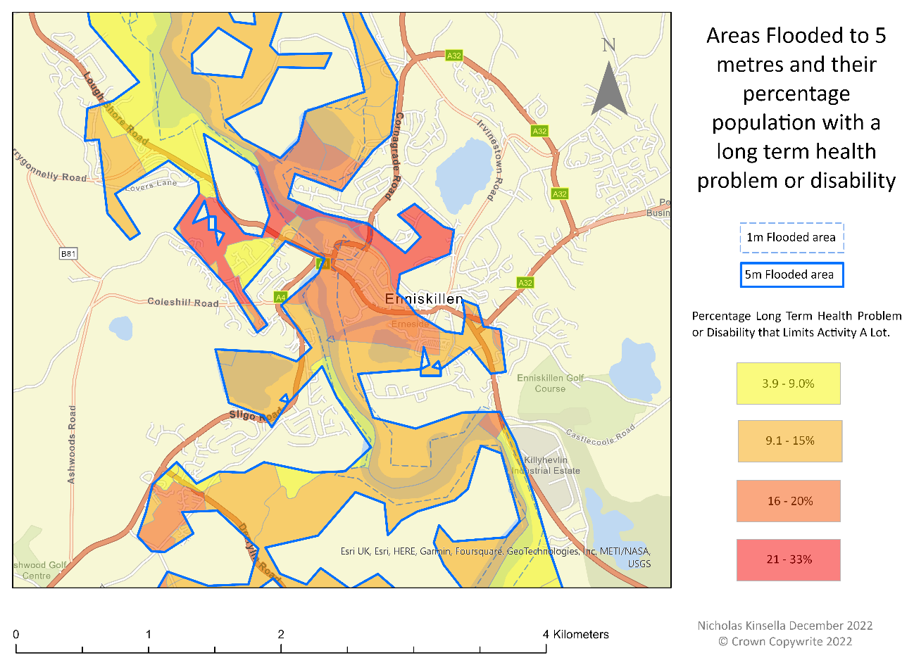
Scenario-based flood planning mapping 1m and 5m inundation against long-term health problems and disability — supporting civil contingency decisions.
Operational wildfire detection, burn scar analysis, and emergency response GIS.
As part of my work at Telespazio, I have worked extensively with Meteosat Third Generation to detect wildfires in real time across Spain, and developed fire spread models to provide early warning.
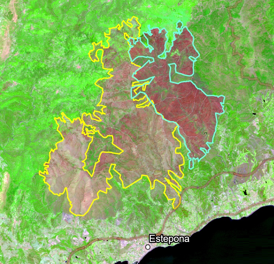
Analysis of burn areas from two wildfires in southern Spain using land cover classification, NDVI, and land surface temperature anomalies.
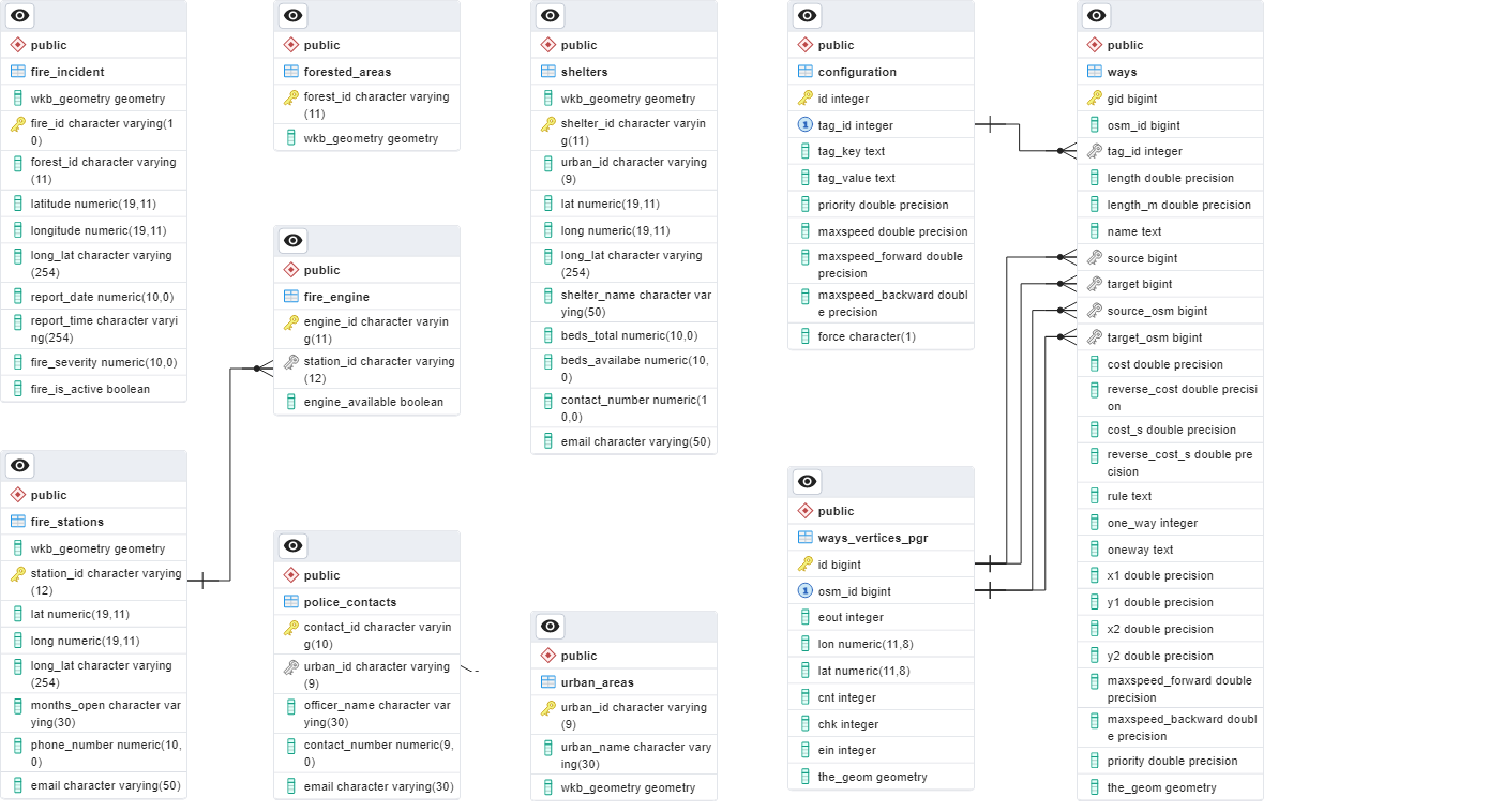
PostgreSQL/PostGIS spatial database for emergency responder routing and wildfire incident analysis, including exposure and needs assessment workflows.
Terrain analysis and lahar hazard mapping from satellite and aerial data.
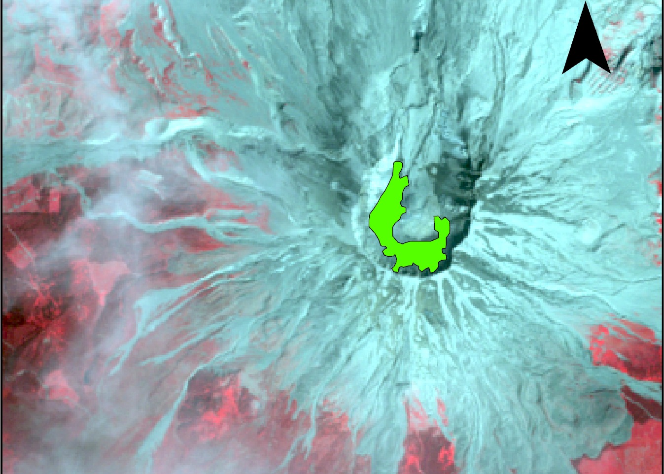
Geohazard analysis combining DEM-derived runout zones, NAIP imagery, ASTER land-cover classification, and Sentinel-2 NDSI change detection at crater monitoring sites.
Protected-area assessment and development constraint analysis.
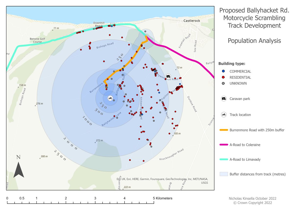
Environmental impact assessment for a proposed track in the Binevenagh AONB — population exposure analysis with buffer zones and building classification.
RUSLE erosion modelling for Northern Ireland catchments.
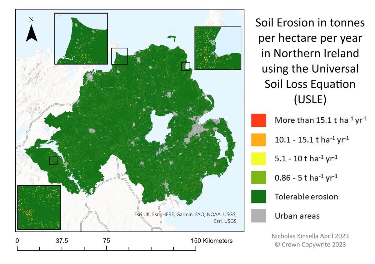
RUSLE-based soil erosion model built in ArcGIS Pro ModelBuilder, combining rainfall, soil, slope, and land-cover factors.
Published Research
Proceedings of SPIE, vol. 13671. Assesses Algeria’s progress toward its 2030 GHG reduction target using Sentinel-2 plume quantification and Sentinel-5P basin-scale inversion.
View publication →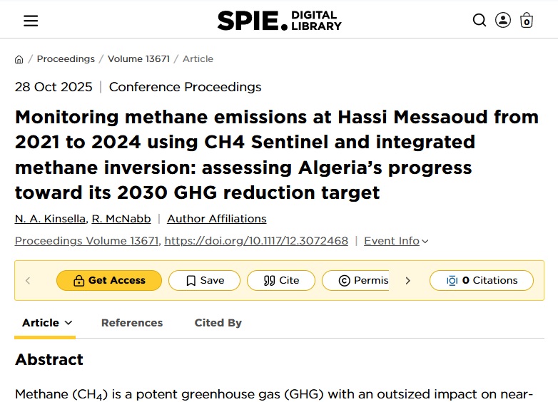
About
I’m Nicholas Kinsella — a geospatial analyst and GIS project manager with a Distinction-level MSc in Geographical Information Systems from Ulster University and a background in geography from the University of Hertfordshire.
My work spans methane emissions monitoring, Earth observation, environmental GIS, and spatial data systems. I developed CH₄ Sentinel during my master’s research, presented findings at international conferences, and have delivered remote sensing analysis for the European Commission, landfill operators, and industry stakeholders.
I currently work as GIS Project Manager at Telespazio and take on independent consultancy engagements. I work in English and Spanish and am eligible to work in the UK and EU.